


MONROE Voting District, Ogle County, Illinois
About
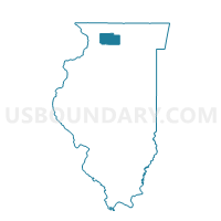
Outline

Summary
| Unique Area Identifier | 573762 |
| Name | MONROE Voting District |
| County | Ogle County |
| State | Illinois |
| Area (square miles) | 36.13 |
| Land Area (square miles) | 36.12 |
| Water Area (square miles) | 0.00 |
| % of Land Area | 99.99 |
| % of Water Area | 0.01 |
| Latitude of the Internal Point | 42.11140050 |
| Longtitude of the Internal Point | -89.00881890 |
Maps


Graphs
Select a template below for downloading or customizing gragh for MONROE Voting District, Ogle County, Illinois


Neighbors
Neighoring Voting District (by Name) Neighboring Voting District on the Map
- CHERRY VALLEY 8 Voting District, Winnebago County, IL
- FLORA 2 Voting District, Boone County, IL
- FRANKLIN 2 Voting District, DeKalb County, IL
- LYNNVILLE Voting District, Ogle County, IL
- ROCKFORD 8 Voting District, Winnebago County, IL
- SCOTT Voting District, Ogle County, IL
- SOUTH GROVE 1 Voting District, DeKalb County, IL
Top 10 Neighboring County Subdivision (by Population) Neighboring County Subdivision on the Map
- Rockford township, Winnebago County, IL (178,527)
- Cherry Valley township, Winnebago County, IL (19,831)
- Scott township, Ogle County, IL (3,181)
- Flora township, Boone County, IL (2,981)
- Franklin township, DeKalb County, IL (2,502)
- Monroe township, Ogle County, IL (1,563)
- Lynnville township, Ogle County, IL (642)
- South Grove township, DeKalb County, IL (512)
Top 10 Neighboring Place (by Population) Neighboring Place on the Map
Top 10 Neighboring Elementary School District (by Population) Neighboring Elementary School District on the Map
Top 10 Neighboring Secondary School District (by Population) Neighboring Secondary School District on the Map
Top 10 Neighboring Unified School District (by Population) Neighboring Unified School District on the Map
- Rockford School District 205, IL (193,932)
- Meridian Community Unit School District 223, IL (9,100)
- Hiawatha Community Unit School District 426, IL (3,324)
Top 10 Neighboring State Legislative District Lower Chamber (by Population) Neighboring State Legislative District Lower Chamber on the Map
- State House District 69, IL (123,633)
- State House District 70, IL (121,976)
- State House District 67, IL (103,737)
Top 10 Neighboring State Legislative District Upper Chamber (by Population) Neighboring State Legislative District Upper Chamber on the Map
Top 10 Neighboring 111th Congressional District (by Population) Neighboring 111th Congressional District on the Map
Top 10 Neighboring Census Tract (by Population) Neighboring Census Tract on the Map
- Census Tract 9610, Ogle County, IL (7,054)
- Census Tract 104, Boone County, IL (6,841)
- Census Tract 37.05, Winnebago County, IL (5,119)
- Census Tract 2, DeKalb County, IL (5,013)
- Census Tract 3, DeKalb County, IL (2,680)
Top 10 Neighboring 5-Digit ZIP Code Tabulation Area (by Population) Neighboring 5-Digit ZIP Code Tabulation Area on the Map
- 61109, IL (28,333)
- 61016, IL (4,837)
- 61020, IL (3,108)
- 60146, IL (2,713)
- 61052, IL (1,148)
- 61049, IL (585)
- 60129, IL (242)